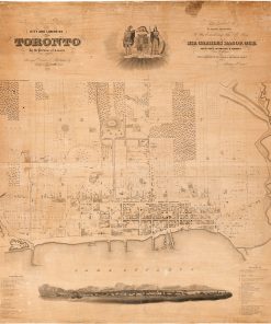
Vintage Map of Toronto Waterfront View
Bird's-eye view, looking n. from harbour to n. of Bloor St. and some points beyond, from Humber R. on the west to Victoria Park Ave. on the east. Published by: Barclay, Clark & Co. Lithographers
Inscription: “Entered according to Act of Parliament of Canada, in the year 1893 by Barclay, Clark & Co. in the Office of the Minister of Agriculture.”
Available in custom sizes and printed on paper, canvas, and a variety of other materials.
Also available custom mounted or framed.
Call us at 416-923-4308 for more information or to order.


